Traveling America By Van: Through Basin And Range
By: John Kumiski
Any book by John McPhee promises a great read. In Basin and Range, he explores the geology of the basin and range areas of the southeastern United States. It's been a few years since last reading McPhee's book, but as we drove down from the Sacramento Mountains onto the Tularosa Basin, I realized I was experiencing the title of his book in a personal way.
Since then we drove through several more range-and-basin structures, a kind of grand geology I'd never have noticed if not for McPhee.
In Permian times this area was submerged, a warm, shallow sea. One can only imagine how the fishing was! Sorry, I digress. Marine sediments piled up on the sea floor, which eventually was lifted by geological forces. The water drained off or evaporated. The deposited materials formed extensive beds of sedimentary rock, beds miles thick (I present the Grand Canyon as evidence for this assertion).
By geologic processes not well understood, parts of the area were lifted further, forming mountains. Volcanism was involved in at least some areas, and old lave flows and cinder cones dot the landscape. The basins were left between the mountain ranges.

We drove north on US 54, following the edge of the Tularosa Basin, to Carrizozo. We passed the post office. Since we had cards to mail, I went around the block. Serendipity struck, because tiny Carrizozo was covered up in street art.
While we marveled, a man came over to us and said, "Welcome to Carrizozo! We're glad you're here!" He turned out to be the town's mayor, one Ray Dean by name. The town has a population of about 1200, 47 of whom are artists. They are looking for people to move there, and are particularly interested in retirees and artists. If you're looking for a small town to retire to...
We eventually left, heading west on US 380, passing through ancient lave flows at the Valley of Fire. The park was closed- they were repaving the road. There was more basin-and-range geology.
We reached Socorro. A quick Wal-Mart stop for supplies and we headed west again, this time on US 60, again observing basin-and-range geology.
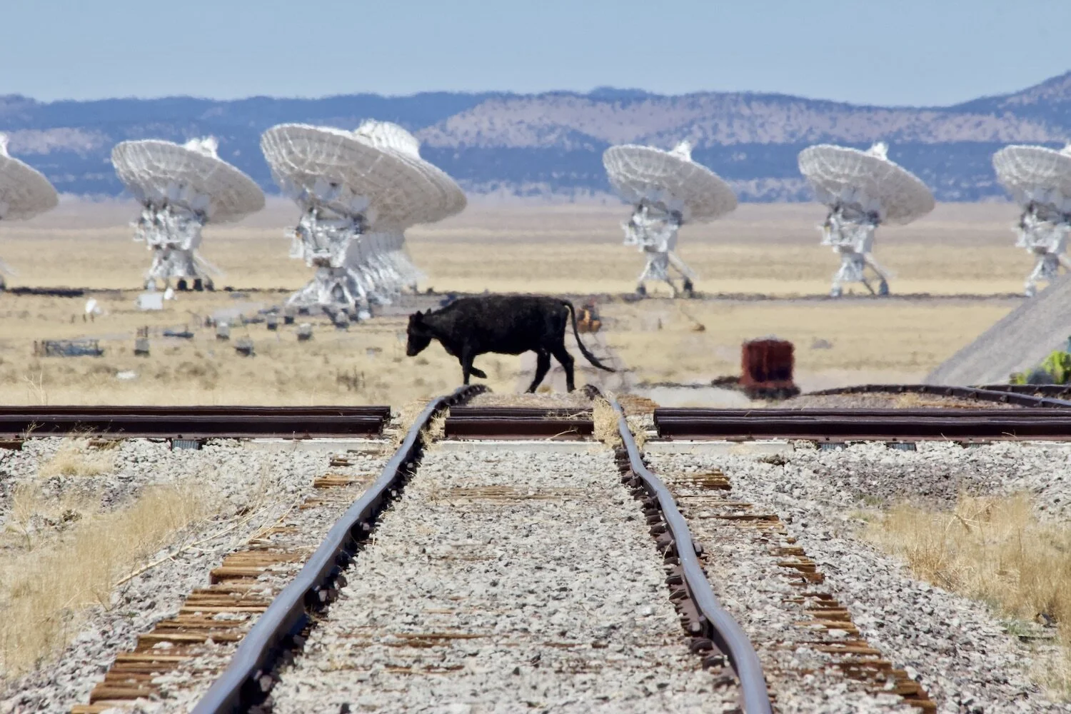
Ray Dean had told us Magdalena was a beautiful little town. It was, but everything there was closed on a Sunday morning. We continued. The Very Large Array was ahead and I very much wanted to see it. From the National Radio Astronomy Observatory website-

"The Very Large Array, one of the world's premier astronomical radio observatories, consists of 27 radio antennas in a Y-shaped configuration on the Plains of San Agustin fifty miles west of Socorro, New Mexico. Each antenna is 25 meters (82 feet) in diameter. The data from the antennas is combined electronically to give the resolution of an antenna 36 km (22 miles) across, with the equivalent sensitivity of a dish 130 meters (422 feet) in diameter."
We got there, only to find disappointment. For the third time in a day, the place was closed, this time because of COVID. The cows could get in, but we couldn't. I got what pictures I could, and we kept on to Datil, where we found our next two night's campsite at Datil Wells.
When we woke up it was 36 degrees. Brrrrr!

Our plan was to drive up to and visit El Morro National Monument, The Bandera Volcano and Ice Caves, and El Malpais National Monument. The drive to El Morro was spectacular but much longer than we'd anticipated. When we got there the sign said, "Closed. Open Thursday, Friday, and Saturday Only." El Morro has been a traveler's oasis since before Columbus. You find petroglyphs there, and inscription that pioneers left when they stopped here on their journeys to the west. But locked is locked. We drove on.
Bandera Volcano, being located on private property, was open. This volcano, which we walked to, blew its top off ten thousand years ago, when the entire region was rife with volcanic activity. At one spot we could see nine cinder cones, with many more out of view. The lava from Bandera flowed over 22 miles, both over the surface and through lava tubes. The Ice Cave is an old lave tube, the inside of which stays cold enough year-round to hold frozen water. The volcano's crater, the ice cave, the whole operation was amazing and well worth the $12 admission and two hours of time.

El Malpais National Monument, a land of volcanos and lava flows, was closed, too.
By now we were easily an hour-and-a-half from Datil Wells. It made no sense to drive back there when we'd have to make up that distance again the next day. We found a campsite at Bluewater State Park, and settled in for what proved to be a chilly night.
Have you done something interesting outdoors? Join Global Outdoors and write a review to tell everyone about it! We’re building the home for trusted reviews of outdoor experiences, outfitters, and guides. Help us out and you’ll be entered to win free trips!

